")
")
")
Müllerthal
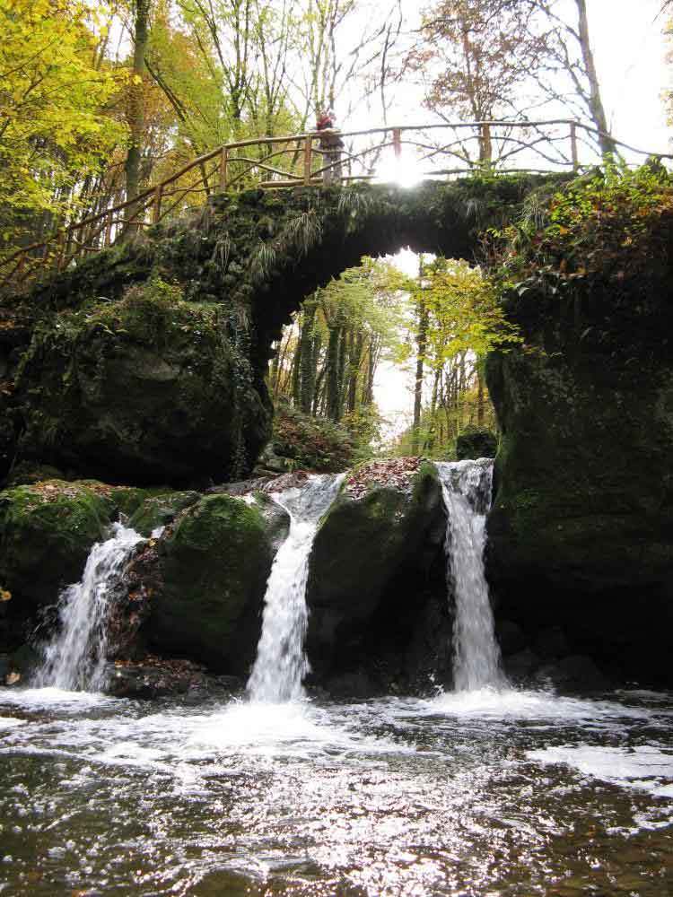
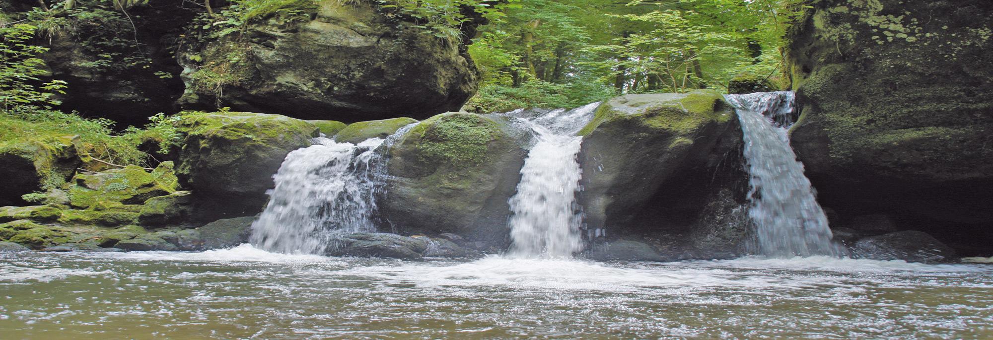
The Müllerthal is an area in the east of Luxembourg to the German border. It falls under the Gutland Mullerthal. Along the Müllerthal runs the busy thoroughfare E29 Echternach in Luxembourg. The Mullerthal Klein Zwitzerland is also known for its rock formations, natural beauty with waterfalls and streams. One famous waterfall is Schiessentümpel.
Luxemburg City
Luxembourg (French: Luxembourg, Luxembourgish: Lëtzebuerg) is the capital of the Grand Duchy of Luxembourg, the canton of Luxembourg and has 92,342 inhabitants (1 January 2010). The rivers Alzette and Pétrusse flow through the city. The name comes from Luxembourg Lucilinburhuc, which means little castle. Luxembourg is one of the richest cities in Europe. It is an important city for the international banking world. At the same time the city with Brussels and Strasbourg is one of the most important sites of European institutions, the European Court of Justice removed.
in 963 Count Siegfried built a castle with a simple defensive wall on Bockfelsen. It is the city of Luxembourg emerge. Over the centuries there were two defensive belts built on the west side. Several engineers, including Vauban, built the city into one of the strongest fortresses in Europe. This was nicknamed Luxembourg Gibraltar of the North.
At the Congress of London in 1867 Luxembourg was declared neutral and had dismantled the fortifications. Only 10% of the fortress is thus preserved, including the casemates that served as a shelter during the Second World War. The old town and a few remaining fortresses were on the World Heritage List in 1994. In 1995 and in 2007, Luxembourg was European Capital of Culture, a status shared in 2007 with the Romanian Sibiu.
Luxemburg
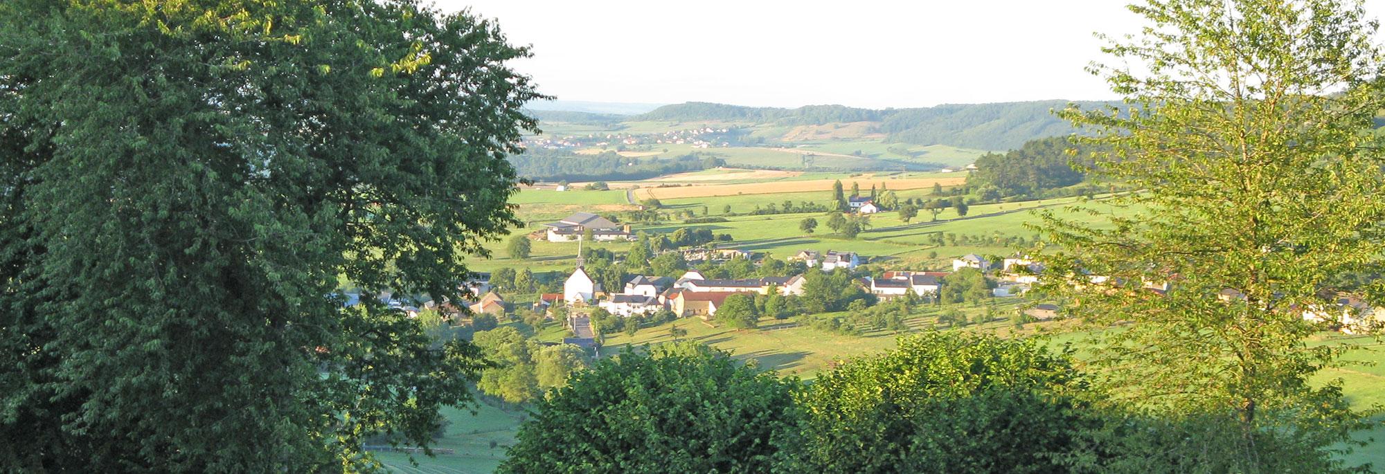
The north of Luxembourg, called the Ösling, is part of the Ardennes. The area has an average height of between 400 and 500 meters and consists of wooded mountains, hills and river valleys. The Kneiff forms the highest point of the country with 560 meters. Much better known is the castle square, but this mountain is two meters lower. In the north of the country at the German border is also the 789 km ² large German-Luxembourg nature park (of it 357 km ² with seat in Luxembourg). Other parks in Ösling include the Nature Park and the Natural Obere Sauer. The southern part of the country is hilly to mention. It is less robust and more suitable for agriculture and life in this area therefore more people and more industry than the north. It is therefore also known as Gutland and it belongs to the Cuesta land of Lorraine. The area becomes more diverse than the north and is geographically divided into several sub-areas. The Luxembourg Plateau in southern central Luxembourg, is a large, flat sandstone formation that is the capital of the country. Little Switzerland (with the Mullerthal) is a rocky terrain with dense forests and is a tourist attraction. Here is a famous waterfall, the shooting pool. The Moselle Valley is the lowest lying subarea and extends along the southern boundary of the country. The Red countries in the extreme south and southwest of the country are the industrial heart of Luxembourg and here are therefore the most important attractions.
The border with Germany is for the most part formed by the Our, Sauer and Moselle. Other rivers are the Alzette in the south of the country, in the north, the Attert and Wiltz Clerve. The valleys of the Sauer and Attert forms the border between the Gutland and Ösling. The lowest point of the country (129 meters above sea level) at the point where the Sure and Moselle meet, at the Wasserbillig.